For DJI Terra maps and Agras spray drones
Find every weed.
Fly every line smooth.
Turn your Terra map into spray spots and calm, canopy-aware routes, built for blackberry in steep, timbered country.
Real survey map. Three picks in, every matching patch found.
Try it
Scan a real map.
Watch the savings add up.
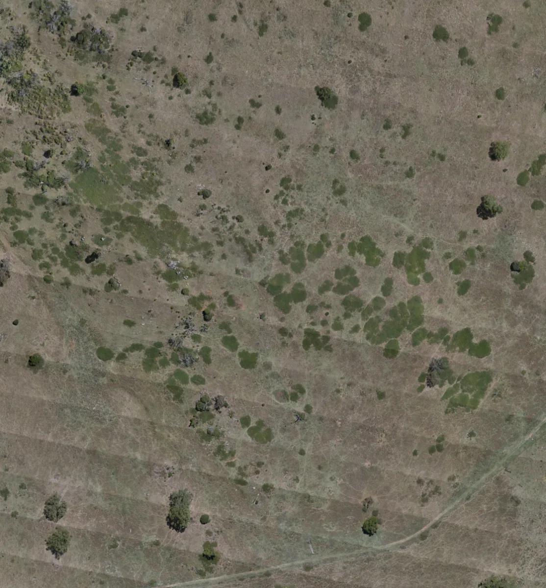
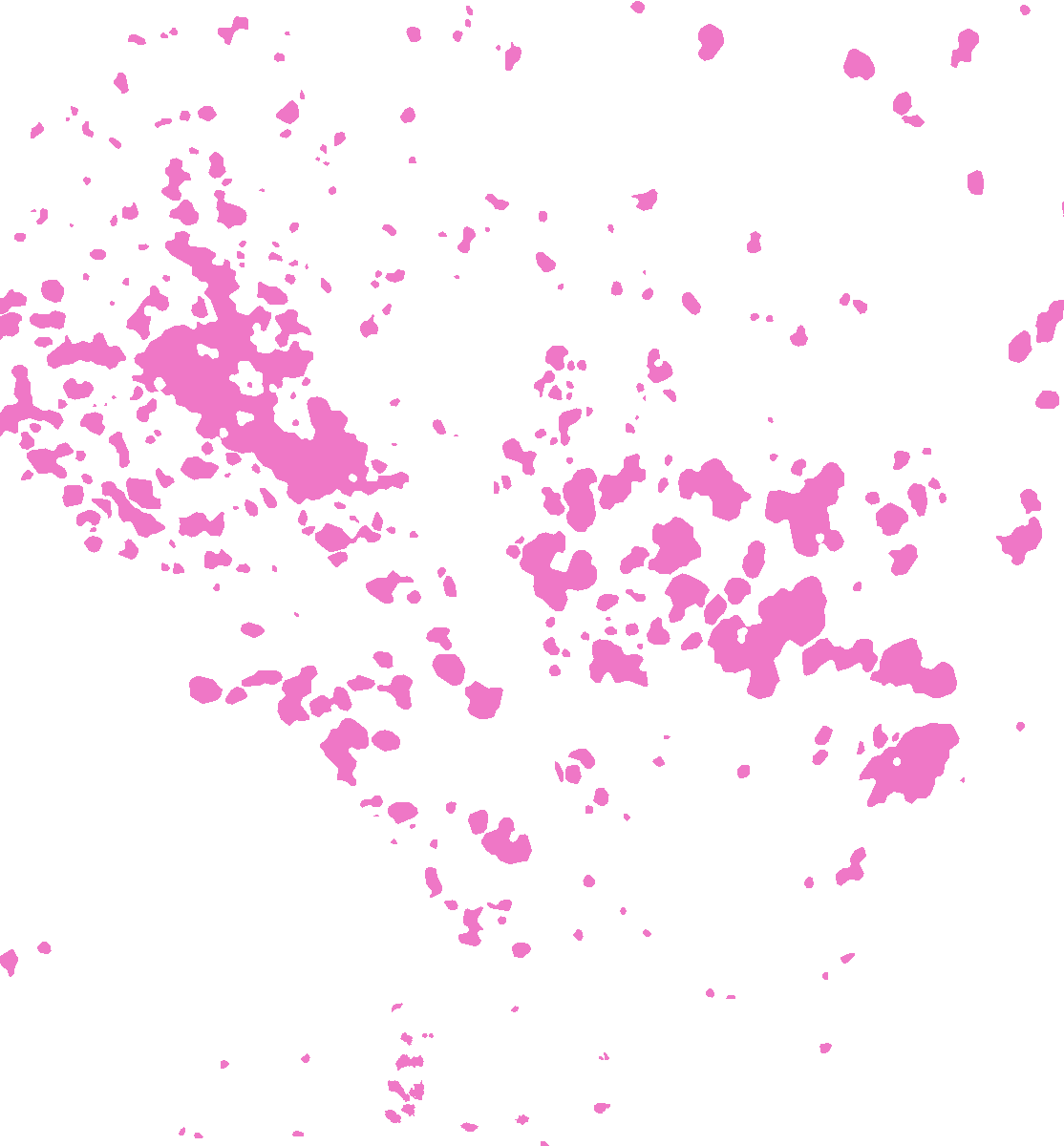
How the flying time adds up
Estimates against blanket spraying the same area. Each patch adds about 4 s to slow, line up and speed up again. Assumes 30 L/ha, a 7 m spray width, 6 m/s spraying, 10 m/s between patches and a 30% buffer around each patch.
Three steps. Map to spray.
Keep the gear you already fly. Canopy Scout slots in between your map and your sprayer.
Map it in Terra
Fly your survey and build the orthomap and surface model in DJI Terra, as you do today.
Drop your spots
Open the map in Canopy Scout. Mark blackberry patches by hand or accept suggested spots, then fine-tune.
Fly it on Agras
Export a smoothed mission straight to your Agras controller. Load, check, spray.
Canopy smoothing
Over the canopy.
Not up and down every tree.
Uneven tree heights make spray drones climb and dive. Canopy Scout reads the surface model and plans one calm line over the canopy, safe on every leg, including the turns between lines.
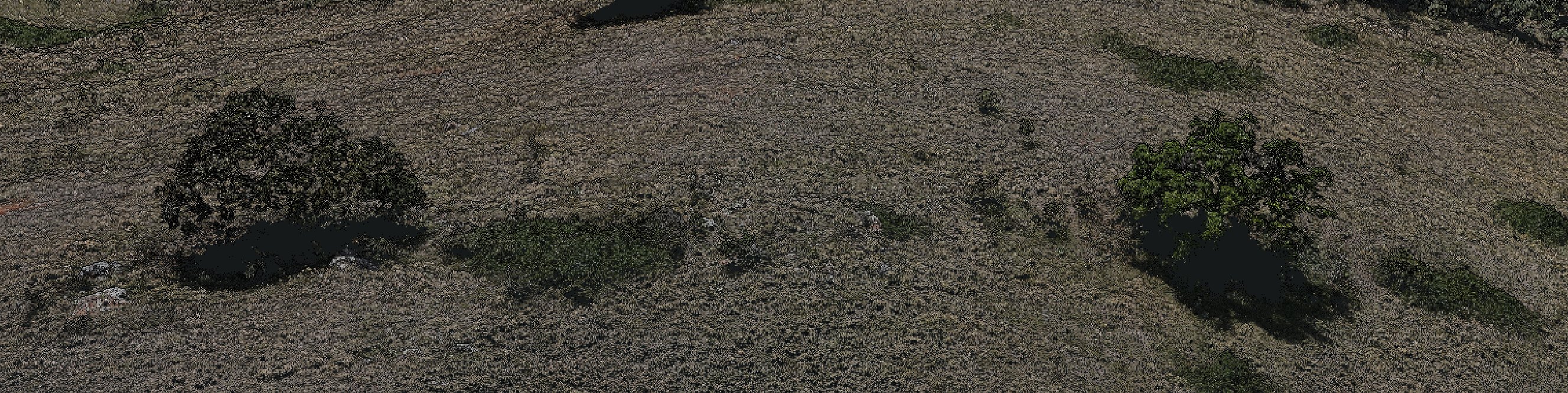
Estimate for the 106 m strip shown, flown at 6 m/s by an Agras T50, which slows to keep vertical speed under 3 m/s. Assumes a 7 m spray width and trees as dense as in this photo.
Built for hard country.
Made for the people doing the spraying.
Spot spraying
Spray the patch, not the paddock. Every spot is a polygon you can see, size and edit.
Steep and timbered
Gullies, creek lines and blackberry under trees: the places crop tools were never built for.
Export that just works
One mission file for your Agras controller. No splitting, no rebuilding in the field.
Who it’s for
Drone spray contractors
Plan jobs faster, use less chemical and quote with a map in hand.
Councils and weed officers
A record of every spot treated, ready for your biosecurity reporting.
Landcare and land managers
Target the gullies you can’t walk into, and see the follow-up next season.
Simple pricing.
Pay per seat. Cancel any time outside the season.
Operator
US$199 / month
One pilot, unlimited maps and exports.
Get early accessAlready subscribed? Log in to your account
Get early access.
Canopy Scout is almost ready. Leave your email and we’ll let you know as soon as you can start using it.